Fujisan
- hm
- Sep 10, 2024
- 9 min read

On multiple trips on the Shinkansen from Tokyo, I have seen the almost perfect, snow-clad Mount Fuji and have wanted to climb it.
The tallest mountain in Japan, with a height of 3,776 m (12,389 ft), it is almost equal to Mount Rinjani in Indonesia. Mount Fuji is a stratovolcano that last erupted in the eighteenth century. The mountain's symmetrical cone is visible from Tokyo, which is about 100 km away.
Mount Fuji is a Japanese cultural icon seen in art and photos and visited by hikers and mountain climbers. It is one of 3 holy mountains in Japan and also as UNESCO world heritage site as of 2013.


To go to the Ryokan close to Fuji was a multi part travel undertaking. First step was the Tokyo to Shinjuku travel on the Marunouchi line (¥180) followed by a trip to Otsuki on the Chuo line (using JR pass), culminating in a cute train named Fujisan Express on the Fujikyuko line to Kawaguchiko (¥1,570). The fast train needs the 400 yen extra ticket and it cuts down the travel time by 45 minutes.

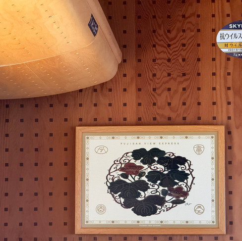


The Fujisan express train is cute inside and out. It has wooden interior with nice paintings of Mt. Fuji.

I discovered that the climbing season concluded on September 10 and there are about 4,000 people allowed to climb Fuji daily if they are able to purchase a ¥2,000 ($~14) ticket. I was able to purchase the Yoshida trail station 5 climb permit for September 9. There are resting huts on the trail which allow you to split the climb over a couple of days, but those tickets were impossible to get.

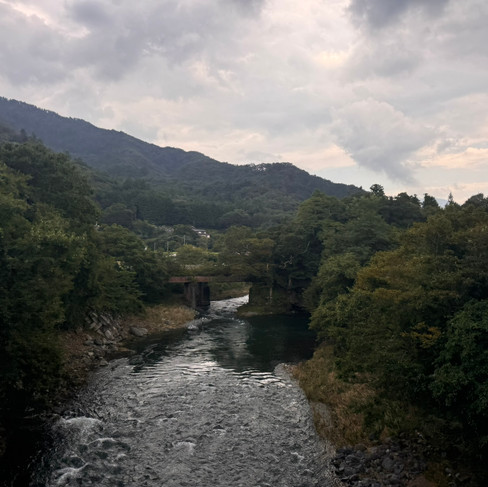

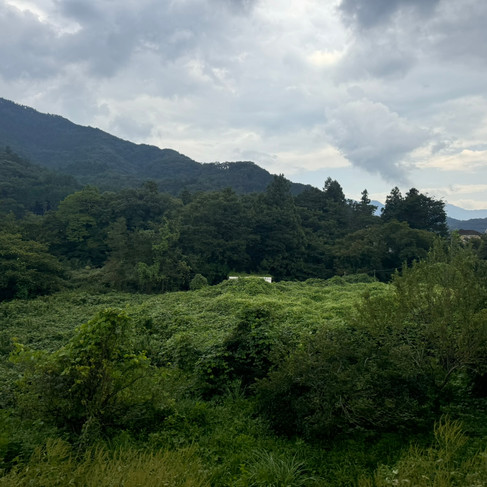


It is a beautiful countryside as one passes from Tokyo to the foothills of Mt. Fuji.

The Fujisan brought me to the lake Kawaguchiko, which usually has the Mt. Fuji view.


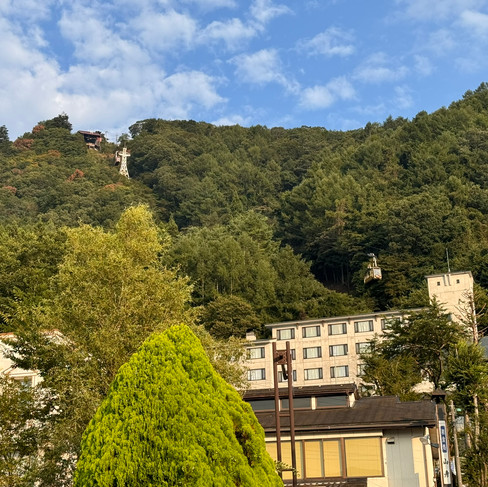


I could see the Mount Fuji Panoramic Ropeway that takes one to the observation point near the top of Mount Tenjo, from where Lake Kawaguchiko and Mount Fuji can be seen. The lake itself is very large and pretty with a lot of small boats on it. There were mountains on each side of the lake with dense forests on them.

I found a restaurant with a nice seafood hotpot, a healthy meal before the climb.
My preference during any mountain climb is to start the trek early. Fuji trails were open only after 5:30am for people without hut reservations. The trailhead was at the Yoshida station 5 was about 19 miles away.
One taxi quoted $120 for the ride and could only offer it at 5:30am with the trailhead drop off at 6:30am. Other taxi companies were all booked. Bicycle rentals did not allow taking the bike to Station 5. Car rentals were sold out. I resigned to using the standard Subaru bus line which had the first service at 6:40am dropping off at 7:40am for about $20 roundtrip fare.

An early morning 20-minute walk brought me to the bus station, and I could see the silhouette of Mt. Fuji.


On the street the prior day, I had met a couple of hikers who advised to buy the bus ticket online because the ticket counter opened only at 6:30am by which time a long line formed at the bus stop. They also recommended arriving early to avoid missing the first bus due to overcrowding.
Sure enough, there was a very long line for the first bus, and thankfully, I was towards the front. The line was growing, and one bus surely could not accommodate all hikers. I was glad I started an hour early from my ryokan, walked a mile and joined the line 40 minutes before the bus arrival. The Australian, Dutch, British, German and Austrian hikers in the line were fun to talk to, some more anxious about the climb than others.
As I waited for the bus, a young, official looking lady approached inquiring if I wanted to participate in a 10-minute survey. It was about shoes and impact of non-native species on the environment. In the characteristic Japanese fashion, a placeholder was put where I stood in the line while I took the survey. My shoes were photographed, and their soles were cleaned. A mat was provided to rest my feet while my shoes were off.

The bus took almost an hour to reach the Station 5, and it passed through beautiful, clean highways flanked by dense wooded regions.


The bus stopped at a location next to the trailhead. There were several cute looking souvenir shops and coffee shops. Before boarding the bus, I had a cup of coffee, which I enjoyed on the bus and when I reached the starting point of the hike, I wanted to dispose of the paper cup, but there are no trash cans anywhere. Even if you buy coffee from the shops near the trailhead, you cannot dispose the cups. I was told that I had to carry it all the way up and then back down to my hotel because they have no garbage anywhere.

A wall on one of the stores had a plaque showing today's date and the elevation of the location for hikers to take their photographs.

The trail started a few meters beyond the stores and I could see that a horseback ride could be had for ¥150,000 (~$105) for going up to the next station, station 6.

Before starting, you have to show the pre-purchased reservation ticket and get a wristband.

The hike started at 7:40am and at about 7600 feet elevation. It was flat at the start for about half a kilometer with black, volcanic gravel but immediately became a relentless climb.

People with the prior day hut pass were descending, while I was climbing, huffing and puffing. However, the gentle breeze and 70°F temperature at 8 AM was comforting.

The trail was wide and gravelly with views of dense forests.

There was a path through a structure to avoid falling rocks and over the entire trail, I found a few more of these.

Soon I reached station 6 where only people descending could purchase water for 600 yen for half a liter while in the city, a 2-liter bottle could be bought for about 100 yen, I was warned about the higher price but had decided to carry less weight.


There were a lot of signs, and it was almost impossible to get lost on this trail.

There were heavy duty barriers constructed everywhere to prevent rock and mudslides.


The barriers were not straight but at an angle. They followed the switchback routes the hikers were taking. They consisted of a steel frame with rocks filling the cavity.

Slippery, multi-colored, volcanic rocks were everywhere.

Some parts of the trail were solidified molten lava, that sometimes needed hands and feet to ascend.

Looking down from the lava rock, the station 6 could be seen.
As I climbed, I talked to fellow climbers and asked where they were from. David and Emma from Canberra Australia were among them.
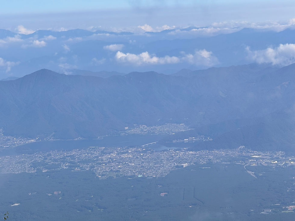
The Kawaguchiko region and the dense forest, the houses of the cities close by were visible as the cloud cover was receding.


Soon, I was at station 7 and only 2 more stations were left. However, station 5 to 7 represented only 1,500 feet climb which meant more torture was coming.
Canberra David passed me and mentioned that Emma had decided to go back as she was too tired to continue.

There were pretty purple flowers on the way.

Looking up, the path ahead seemed daunting.
To my surprise, Emma from Canberra passed me and said she had decided to give it her best effort. I was glad and encouraged her to keep on going.

I could see there was a Tori at the end of the lava rock climb.


The shop next to the Tori offered hot, sweet milk tea. The shopkeeper lady was friendly; she shared that she was a nurse and a mountain rescue staff.

The next route was also tough looking.

Looking back, I could see more people scrambling to the top on the switchbacks I had recently walked up.

The huts were good looking but could not be entered if you did not have a reservation.

Japan has a seemingly infinite number of snack types and I had bought the fried, salted whole Garlic snack which tasted delicious.

More rocky ascent ensued.

I could almost see the very top and the clouds seemed to be enveloping the top.

The path with patch of rocks seemed like it was repeating several times.

Station number 8 was visible at a distance.

On hikes above 10,000 feet, I usually take acetazolamide, a stronger, prescription version of diamox. It helps with the thinner oxygen. Usually 500mg the day prior and on the day of climb is sufficient.

Prince Shotoku Tashi from the 7th century imperial
Asuka period (6c. - 7c. ) climbed Fuji on a black
horse and rested at the location near station 8.

In the Edo period, people formed communities to worship Fuji and made miniature Fuji near their home to climb instead of the real mountain. They collected funds and donated items to the hut dwellers at the base of Fuji.

The path was steeper now, and I was stopping more often. Sometimes after 30 steps my heart rate went to 170bpm and a few minutes of rest allowed me to resume the climb.

I could see hikers resting at the station 8 above.

The steps with wood and steel grid looked quite elegant; the wooden stumps were kind of stitched with the steel thread.

I was almost there, just over a mile to go.

The elevation was 10,700 feet and the summit was at 12,388 feet, so the last one mile was going to entail 1,688 feet climb.

The park rangers were maintaining the trails and I was amazed at how clean their equipment looked.

More slippery volcanic rock was ahead.

Dense gray and white clouds were gathering while was worrisome.

Finally I was at 8th station and only one more station to go!

Surprisingly, there was a half step, 8.5 station that was coming up.

Blue skies prevailed despite the rising clouds.

It was getting very close now.

The Tori had many coins of various values, many of 100 yen, and people had put them in the cracks in the wooden pillars of the Tori.

The summit seemed within reach now.

The last Tori with lions was a few meters from the summit.

I was at the summit and could see the stream of climbers on their final stretch.

There was a flat surface at the summit with many benches for resting.
It was a feeling of pure joy to finish the ascent and experience the mountain which has so much significance in the Japanese culture.

About 100 meters with a 200 feet climb ahead, you could see the caldera.
Surprisingly, the cell signal was strong at the summit.

After relaxing for an hour, I started the descent.

The yellow vegetation in the red lava rock looked pretty.

There were many switchbacks and a numbered pole with information was at the end of each one.

The path was relatively wide, gravelly, slippery with thick layer of sharp volcanic pebbles.

Some people were walking slow, some sideways, most with hiking poles or sticks that could also be purchased at all the stations. At each station, there was a service to burn a stamp onto the wooden stick with a hot metal stamp.


The downhill was quite steep. I have always used the Keen brand shoes and decided to purchase La Sportiva brand ones, however, they hurt the toes on my wide feet. I replaced them with the Woodland brand that is popular in India. They fit fine but looked narrow in the front.
I was delighted that climbing with these Woodland shoes was pain free and I could run down the descent often. However, after a while, my toes hit the front of the shoe and started hurting, probably overgrown toenails contributed to it. I was descending and running, screaming in pain at times, overtaking many hikers, who looked at me like I was crazy.
I saw many people who I had talked to during the ascent, and I called them by their country names: Scotland, Sweden, Gabon, France, Denmark, Philippines, Germany, Netherlands, U.S., Japan, and so on. I also passed Canberra David and Emma who had successfully summited and were carefully treading on the slippery downhill.

In less than 90 minutes, I was at the station 6, where I met an Indian climber with a hut reservation going up. Since he did not have the acetazolamide, and I had just the right quantity to share, I gave him the tablets and proceeded.

The view of the Kawaguchiko lake was pretty.

The city was visible too.

The last part of the hike had a prolonged climb which I was unprepared for and struggled through.

Soon I was a few meters from the exit and the park had provided for many brushes to dust off your shoes.
Just near the exit, I found someone’s Lloyd bank Debit card and picking it up, I wondered how to find its rightful owner. I took it to the police station nearby and they filled a form, took the card, thanked me profusely and gave me some rice crackers.

From the parking lot, I could see the Mount Fuji, there were no clouds in sight, and it looked serene.

Every half an hour or so, I had used the watch alarm to track altitude and temperature. The temperatures were relatively constant, I plotted the elevation against time and saw the asymmetry between ascent and descent times.
I was glad to have completed this climb. It seemed easier than Mount Rinjani on Lombok, Indonesia, which has almost the same altitude. Next time I pass the mountain and view it from the Shinkansen bullet train, I would be reminded of this hike.
Comments